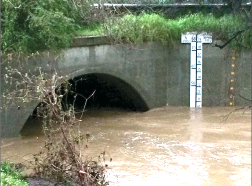
The Post first published this story in Thursday morning’s edition. An update based on Thursday afternoon’s meeting of the creek authority is on the front page of Friday’s Post. To get all of the important local news first, pick up the Post in the mornings at 1,000 Mid-Peninsula locations.
BY BRADEN CARTWRIGHT
Daily Post Staff Writer
Hydrologists were wrong about where and how much the San Francisquito Creek would flood during a storm, and after updating their models, they’re suggesting leaving in the Pope-Chaucer Bridge and putting a flood wall along the creek instead.
Taking out the bridge without putting in a flood wall would protect homes on Hale Street and Seneca Street, but more flooding would occur downstream on Menalto Road, Oak Avenue, Palm Road, University Avenue and Cooley Road, according to a report from Valley Water engineer Jack Xu.
Years of planning
With a new bridge, “flood waters that currently exit the channel upstream of the Pope-Chaucer Bridge would be transferred downstream, and much of the low-lying areas on both sides of the creek would continue to be in the floodplain,” Xu said, noting that East Palo Alto would be especially vulnerable.
Replacing the Pope-Chaucer Bridge has been planned for years to protect homes in Menlo Park and Palo Alto, along with widening the channel and replacing the Newell Road Bridge.
The San Francisquito Creek Joint Powers Authority was formed after a flood in February 1998 to do these projects.
$58 million price tag
The city of Palo Alto is planning to replace the Newell Road Bridge in 2024. Then the creek authority is planning to widen the channel and repair existing flood walls in 2025 and replace the Pope-Chaucer Bridge in 2026.
The latest cost estimate for all of the projects is $58 million. Xu updated the models after the creek overtopped its banks on New Year’s Eve in places that scientists hadn’t predicted before.
The old models, which were created in 2009 and updated in 2016, underestimated how much vegetation was in the creek, Xu said.
Xu pointed out several errors by Valley Water and the creek authority.
For example, maps of the 1998 flood missed many flooded areas, and a smaller flood in 2012 was incorrectly chalked up to a fallen tree. The channel capacity was overestimated by as much as two feet in some areas, Xu said.
The board of the San Francisquito Creek Joint Powers Authority, which is made up of cities and water agencies along the creek, will discuss the new models at 3 p.m. today at Menlo Park City Hall.
To prevent flooding in a storm like the one on New Year’s Eve, a floodwall that extends one foot above the embankment would need to run along the creek for about 2,000 feet, Xu said.
If the creek authority wants to protect homes from a flood like the one seen in February 1998, then that wall would need to be higher and longer, Xu said.
Newell Road Bridge still OK
The new model doesn’t impact Palo Alto’s plans to replace the Newell Road Bridge, according to a report from Margaret Bruce, executive director of the creek authority.
The creek authority will hire someone to independently review the updated model, and plans can be changed after that’s done, Bruce said.
The creek authority will also survey the channel on foot and work with cities to remove dead trees and invasive species growing in the channel, Bruce said.
“The implications of these findings are that the top-of-bank project elements will need to be re-scoped and likely expanded – in length, and in some places, in height. This will add to the cost of this project,” Bruce said.
